


"Astro Navigation from Home"
A new book with a major twist ! It is probably the first truly home based teach yourself astro navigation guide. Using a planetarium App as a sextant simulator, you can take your sights and process them just as you would in a real situation but in your own home and in your own time. If you are already familiar with the subject, you can practice and keep in tip-top shape.
The book is a detailed and thorough guide to astro navigation. If you already have all the sight reduction and other tables, then fine, otherwise you are directed to where you can download them as pdf files free of charge, along with a choice of one of the two low cost planetarium apps used in the book.
Another big advantage is that you can set up your own scenarios for practice, you are not restricted to examples set by the author. This is also ideal for those who just want to keep their practice up, even using actual scenarios from you log book, last season.
The book takes you right from the beginning through to plotting your position, both manually using plotting sheets and also utilising plotting software.
You can teach yourself or, enjoy the book as a companion to the RYA or other Astro Navigation courses.
Astro Navigation from Home
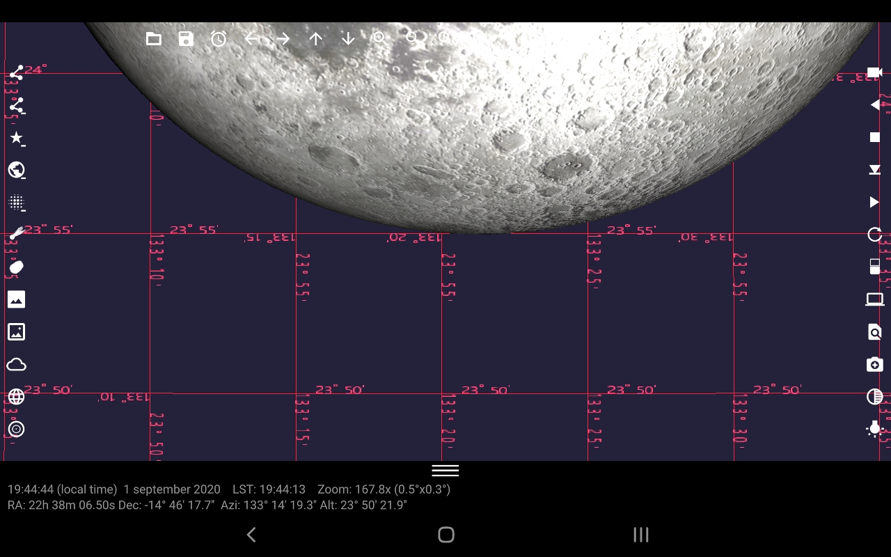
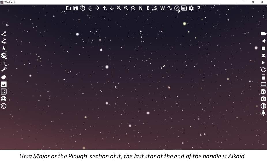
A Screen shot of Winstars showing the "Plough" and Polaris over to the far right (by the rectangle icon).
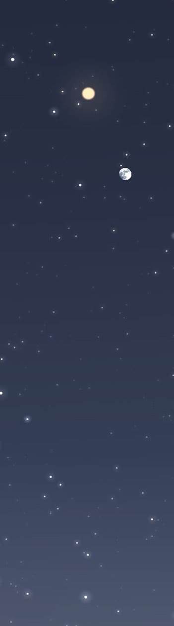
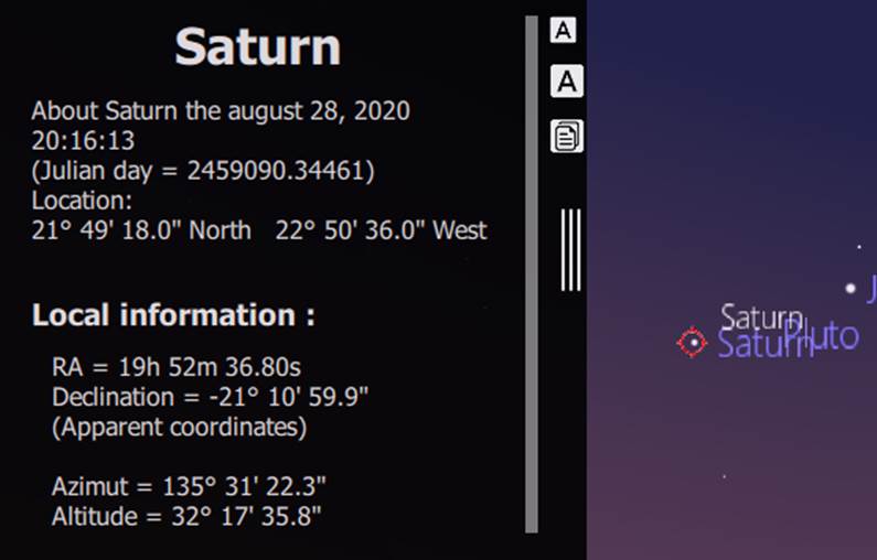
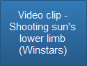
"Shooting" Saturn, just find the planet, double click on it and the side panel comes out. Amongst the information is the "Altitude", the angle from your horizon, the bit you want. This is "Hs" and is the same as the angle you would have measured with your sextant.
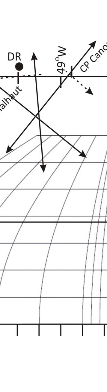
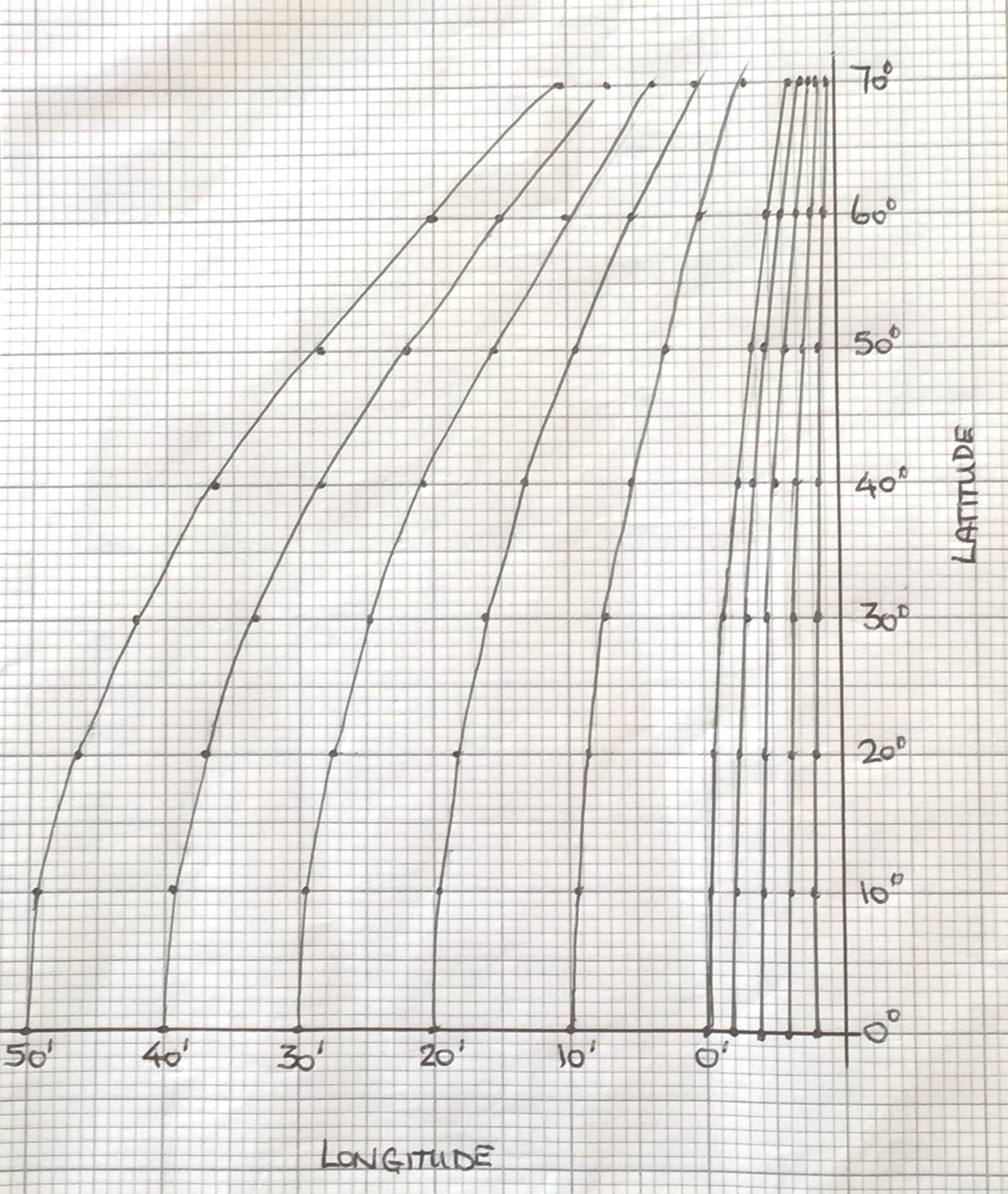
Having created the Longitude Scaling Grid (Appendix 4), intercepts and bearings are plotted on graph paper. The scaling grid is valid for all plots using the same type of graph paper.
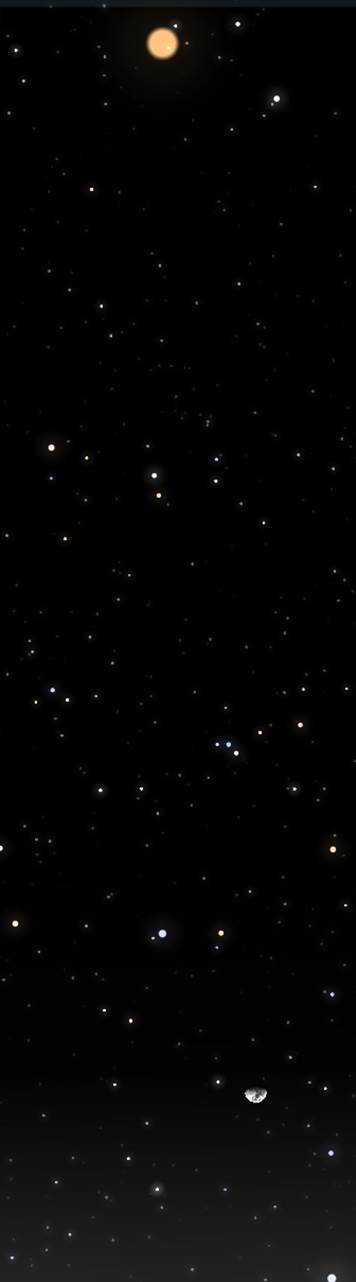
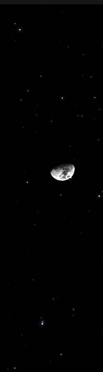
For all the heavenly bodies, you need to measure the altitude of their centre. Because of the size of both the sun and moon, you can only measure the altitude of the upper or lower limb with any accuracy. The correction to give you the altitude of the centre is given in a table and applied to your sight. It also accounts for the variation in apparent size throughout the year. On the planetarium app, you can zoom in and measure the limb altitude directly off the grid, or using the mouse cursor. Examples are shown on the "How To" pages.
Sextant on board your vessel :
DATE
DR Position based on
previous fix
Select heavenly bodies :
Best 3 stars
Sun / Moon / Planets
Out on deck with sextant and deck clock
Take sights :
note altitudes and sight
times
Astro navigation
from home :
DATE
Choose vessel's
Actual Position (AP) - Enter into app
DR Position
Chosen near to AP
Select heavenly bodies :
Best 3 stars
Sun / Moon / Planets
Find a comfy armchair with
your phone, tablet or laptop
Enter date and nominal sight time into app and set running
Take sights :
note altitudes and sight
times
Comparing "Astro Navigation from Home" process to that of a sextant on board
Comparing "Astro Navigation from Home" process to that of a sextant on board
Astro navigation
from home :
DATE
Choose vessel's
Actual Position (AP) -
Enter into app
DR Position
Chosen near to AP
Select heavenly bodies :
Best 3 stars
Sun / Moon / Planets
Find a comfy armchair with your phone, tablet or laptop
Enter date and nominal sight time into app and set running
Take sights :
note altitudes and sight
times
Sextant on board
your vessel :
DATE
DR Position based on
previous fix
Select heavenly bodies :
Best 3 stars
Sun / Moon / Planets
Out on deck with sextant and deck clock
Take sights :
note altitudes and sight
times
Comparing "Astro Navigation from Home" process to that of a sextant on board
Sextant on board your vessel :
DATE
DR Position based on
previous fix
Select heavenly bodies :
Best 3 stars
Sun / Moon / Planets
Out on deck with sextant and deck clock
Take sights :
note altitudes and sight
times
Astro navigation
from home :
DATE
Choose vessel's
Actual Position (AP) -
Enter into app
DR Position
Chosen near to AP
Select heavenly bodies :
Best 3 stars
Sun / Moon / Planets
Find a comfy armchair with your phone, tablet or laptop
Enter date and nominal sight time into app and set running
Take sights :
note altitudes and sight
times
"Astro Navigation from Home"
A celestial navigation book with a twist ...
Like many people, I am fascinated by the day and night sky. There is nothing quite like a night passage with a cloudless sky, trying to make some sense of everything. The sheer numbers used to describe the vastness are too much so I just enjoy what I can see. To have the ability to use some of those heavenly bodies for navigation is really quite special.
Excluding any electronic aids, the subject has not changed so yet another book from me had to have a twist. That came in the shape of simulating a sextant with a planetarium app, allowing valid sights of heavenly bodies to be taken. Having got around the sextant problem then astro navigation can truly be learned in your own home and in your own time. Once you have the sight, everything else is number crunching.
“Astro Navigation from Home” is probably the first truly home based teach yourself astro navigation guide and a great companion to sailing school and academy courses. Starting at the basics, it explains every step of the way through to the final position plot, even showing how to make your own plotting sheet if you need to and looking at one of the many plotting software packages that are available. The only things you need are a computer / tablet, ruler, protractor, compasses or dividers and some graph paper. In addition to the hardware, you will need all the sight reduction and correction tables. If you don’t have these already, the book details the web sites from which these can be freely obtained as pdf downloads. The book does not depend on using the planetarium software, however, it does add an additional dimension to the learning process. Both apps are low cost (at time of writing) and are ideal for helping you to identify where your target heavenly bodies will be in the sky.
2. Observed data, what you can measure : This section details how the planetarium apps are used as a sextant simulator. Whilst they were not designed for navigation, there are detailed explanations for both options that enable you to “Shoot ” the angle or “Altitude” of your chosen heavenly body. No sextant (or cloudless sky) required.
5. Apps, tables and software : Looking at how either of the apps are used to take you sights and where you can freely download the nautical almanacs and all the correction tables you will need. If you have your own hard copies, either from the current year or a previous one, they can still be used as the apps don't care what date you apply so you can still create your own practice scenarios.
1. Solar system for Navigators : This looks at the definitions and concepts that are fundamental to astro navigation, including Time which is so important to get right.
3. Observed data corrections : Starting to work with the sight data, this section explains all the corrections that are applied due to the Earth, its atmosphere, variations in orbits and so on. It also details planning your sights, choosing the best stars, planets, moon and of course the sun as well as obtaining your Latitude from each of these.
4. The Sight Reduction Tables and Calculated data : Finally, this is where much of the action takes place. There are explanations of all the tables and how they are used along with their corrections. The concept and practicalities of the “Chosen Position” method resulting in intercepts and bearings. Finally … plotting your results to obtain your position fix.
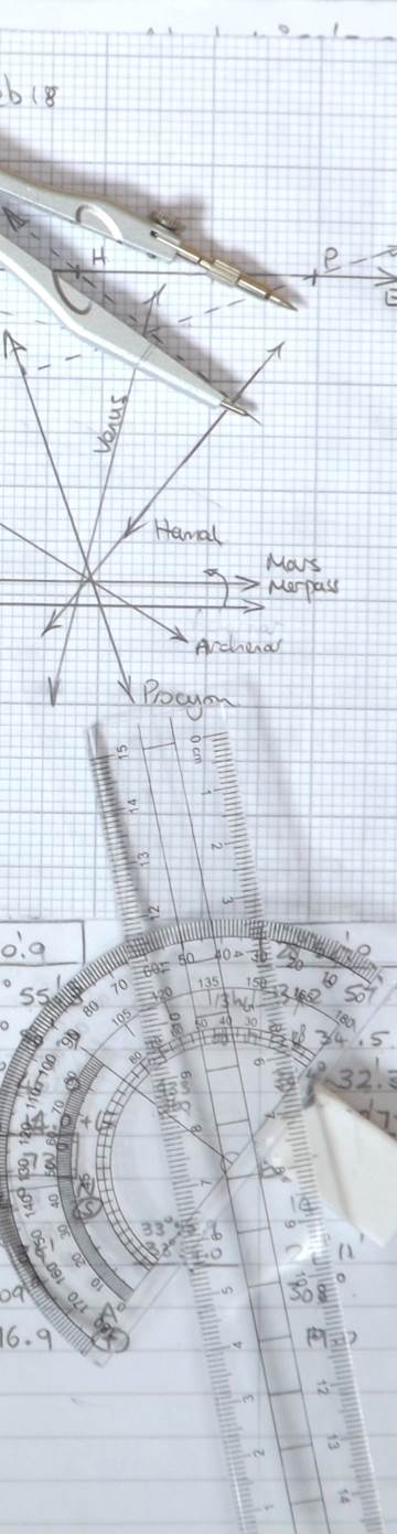
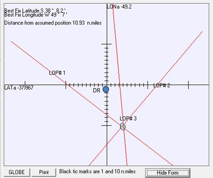
Once the intercepts and bearings are calculated for each of the sights, they can be plotted. Plotting sheets need the Longitude Scaling Grid so that the correct longitude measurement according to your latitude is made (Appendix 4). Below is the "TeacupNav" plotting software (Appendix 5) which gives the same resultant fix, despite the different appearance. Once set up, you just enter the altitude readings.
6. The Appendices :
Appendix 1 : Works through some 3 star fix scenarios, starting with the date and an estimated position from a previous fix, ending with plotting the new position and everything in between being fully detailed. One throws in a planet sight as well and the third scenario looks at what can go wrong when selecting your stars.
Appendix 2 : Conversion of Azimuth Bearing to True Bearing. A mathematical explanation of the conversion from Z to Zn bearings. This shows how the “precepts” to the conversion are derived.
Appendix 3 : List of stars with Declination below 29o.
Appendix 4 : Creating a plotting sheet.
Appendix 5 : TeacupNav plotting software.
Appendix 6 : A worked example of a “Sun – Run – Sun” fix.
Astro Navigation from Home is in 5 sections :
In preparation for shooting Polaris, a screen shot of Winstars showing the "Plough" and Polaris over to the far right (by the rectangle icon).
"Shooting" Saturn, just find the planet, double click on it and the side panel comes out. Amongst the information is the "Altitude", the angle from your horizon, the bit you want. This is "Hs" and is the same as the angle you would have measured with your sextant.
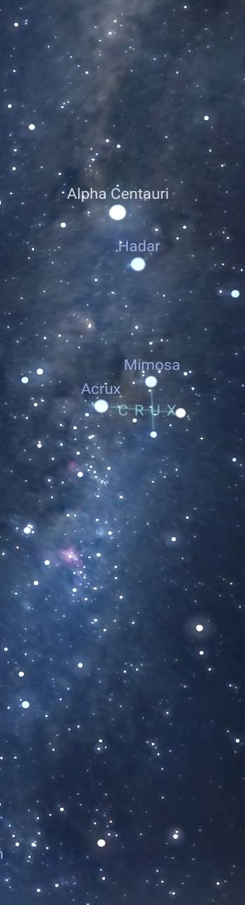
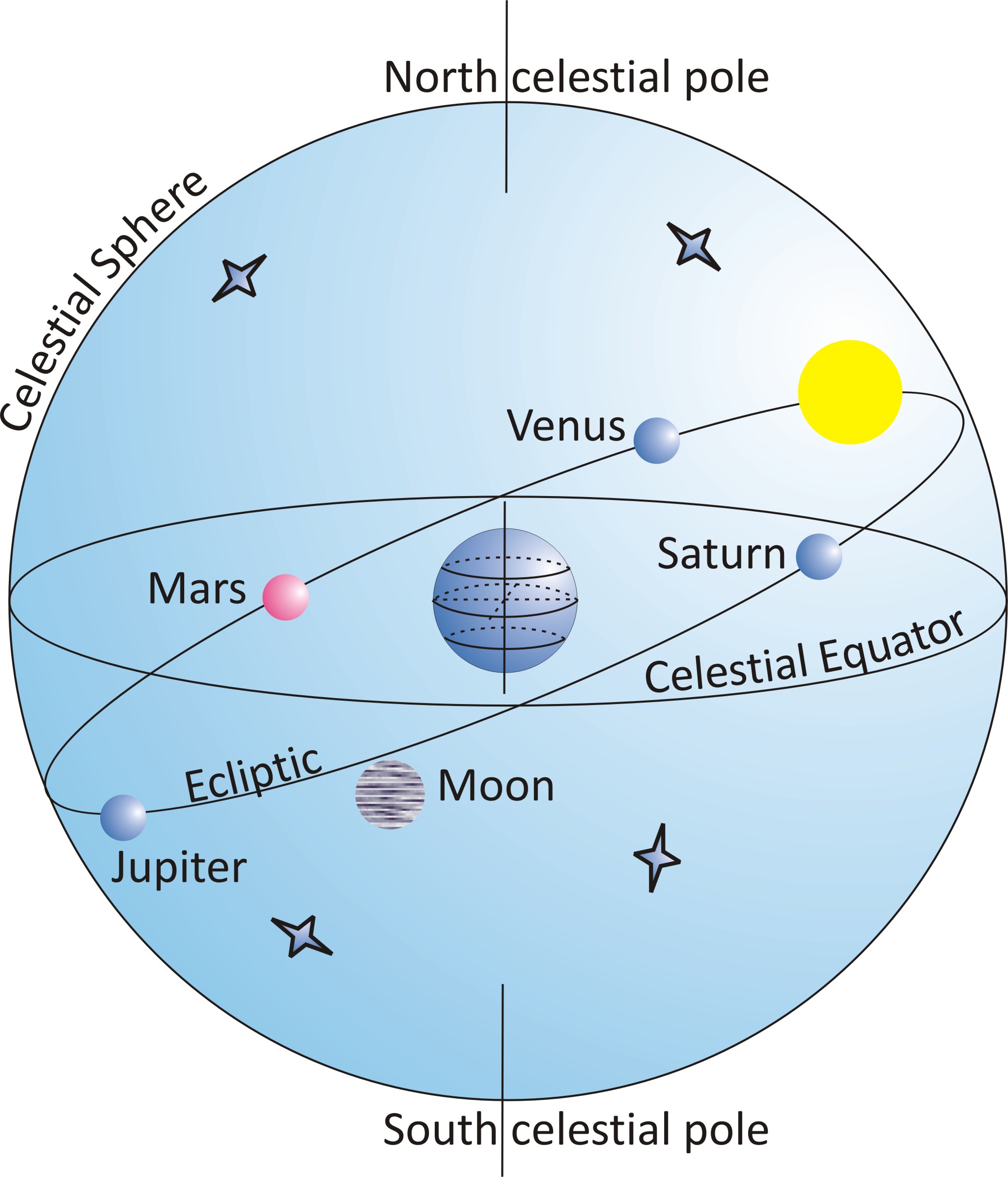
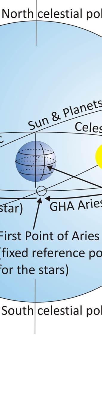
The Celestial sphere places a rotating Earth at the centre and all the stars in their fixed positions out on the sphere. The sun and planets orbit around the "Ecliptic" plane with the Moon a further 5 degrees off. For convenience the Earth is upright and the ecliptic plane is at 23.4o tilt.
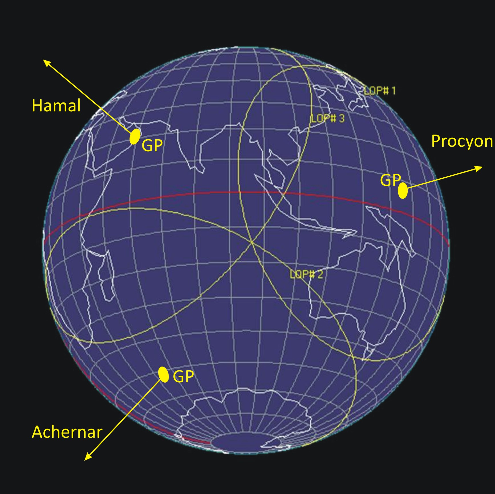
The measured altitude of the heavenly body is used to calculate the radius of a position line, the "Circle of Position" (COP) around the heavenly body's "Geographical Position", the point on the Earth's surface directly underneath its location on the celestial sphere. Your vessel is on the COP, you just don't quite know where yet. You need more sights with their COPs to give you the fix.
For all the heavenly bodies, you need to measure the altitude of their centre. Because of the size of both the sun and moon, you can only measure the altitude of the upper or lower limb with any accuracy. The correction to give you the altitude of the centre is given in a table and applied to your sight. It also accounts for the variation in apparent size throughout the year. On the planetarium app, you can zoom in and measure the limb altitude directly off the grid, or using the mouse cursor. Examples are shown on the "How To" pages.
2. Observed data, what you can measure : Having taken your sight (Hs), this section details all the corrections that need to be made to the sextant or planetarium app sight. There are worked examples of applying the correction with illustrations of the appropriate tables used.
5. Apps, tables and software : Looking at how either of the apps are used to take your sights and where you can freely download the nautical almanacs and all the correction tables you will need. If you have your own hard copies, either from the current year or a previous one, they can still be used as the apps don't care what date you apply so you can still create your own practice scenarios.
1. Solar system for Navigators : This looks at the definitions and concepts that are fundamental to astro navigation, including Time which is so important to get right.
3. Welcome to the Nautical Almanac: Starting to work with the sight data, this section details how to use the Nautical Almanac and the Increments and Corrections table. Particular reference is given to the "v" & "d" corrections. It also details planning your sights, choosing the best stars, planets, moon and of course the sun as well as obtaining your Latitude from each of these.
4. The Sight Reduction Tables and Calculated data : Finally, this is where much of the action takes place. There are explanations of the 3 volumes of the Sight Reduction Tables and how they are used along with their corrections. The concept and practicalities of the “Chosen Position” method resulting in intercepts and bearings and finally … plotting your results to obtain your position fix.
Once the intercepts and bearings are calculated for each of the sights, they can be plotted. Plotting sheets need the Longitude Scaling Grid so that the correct longitude measurement according to your latitude is made (Appendix 4). Below is the "TeacupNav" plotting software (Appendix 5) which gives the same resultant fix, despite the different appearance. Once set up, you just enter the altitude readings.
6. The Appendices :
Appendix 1 : Works through some 3 star fix scenarios, starting with the date and an estimated position from a previous fix, ending with plotting the new position and everything in between being fully detailed. One throws in a planet sight as well and the third scenario looks at what can go wrong when selecting your stars.
Appendix 2 : Conversion of Azimuth Bearing to True Bearing. A mathematical explanation of the conversion from Z to Zn bearings. This shows how the “precepts” to the conversion are derived.
Appendix 3 : List of stars with Declination below 29o.
Appendix 4 : Creating a plotting sheet.
Appendix 5 : TeacupNav plotting software.
Appendix 6 : A worked example of a
“Sun – Run – Sun” fix.
The book is in 6 sections :
Corrections table listing the separate tables and how they are applied.